
When Should Drone Photography Be Used for a Real Estate Listing?
When Should Drone Photography Be Used for a Real Estate Listing?
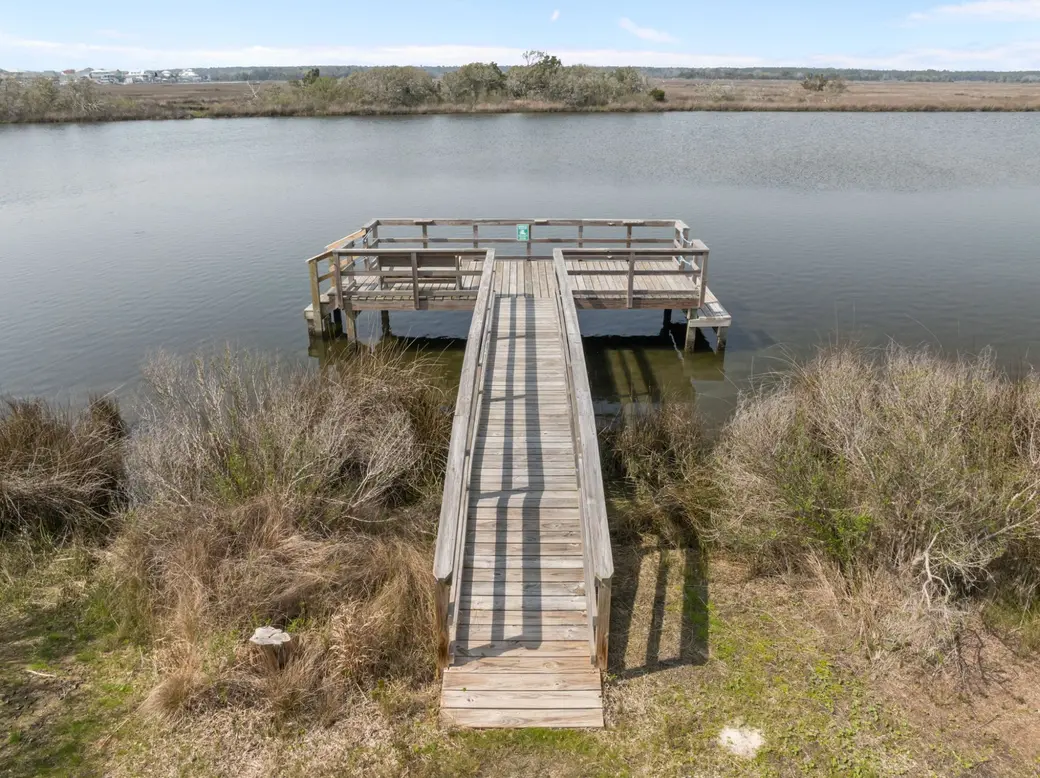
Drone photography can be a valuable addition to a real estate listing when aerial images help buyers understand features that traditional ground-level photography cannot fully capture. It is especially useful for waterfront properties, oceanfront homes, large lots, vacation properties, and homes where the surrounding location is an important part of the property's appeal.
However, drone photography is not necessary for every home. The decision should be based on whether aerial images provide meaningful information about the property and help communicate its value to prospective buyers.
For homeowners considering selling in Surf City, Topsail Beach, North Topsail Beach, and other Coastal North Carolina communities, drone photography can be an important part of a property-specific marketing strategy.
Why Is Drone Photography Important When Selling a Home?
Traditional real estate photography shows buyers what a home looks like from the ground. Drone photography provides another perspective by showing the property from above and placing it within its surrounding environment.
This can help buyers better understand:
-
The property's location and surrounding neighborhood.
-
The size and layout of the lot.
-
Proximity to the ocean, Intracoastal Waterway, or nearby waterways.
-
Outdoor living areas, pools, and landscaping.
-
Docks, boat lifts, and waterfront features.
-
The relationship between the home and nearby amenities or access points.
For some properties, these details are important selling features that may be difficult to communicate through traditional photographs alone.
The goal is not simply to make a listing look more impressive. It is to provide prospective buyers with a more complete understanding of the property.
When Should Drone Photography Be Used for a Real Estate Listing?
Drone photography is particularly beneficial when a property's location, setting, or outdoor features contribute significantly to its appeal.
Here are several situations where aerial photography may make a meaningful difference.
1. Oceanfront and Beachfront Properties
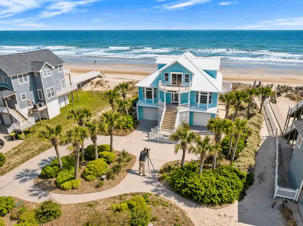
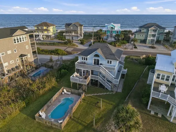
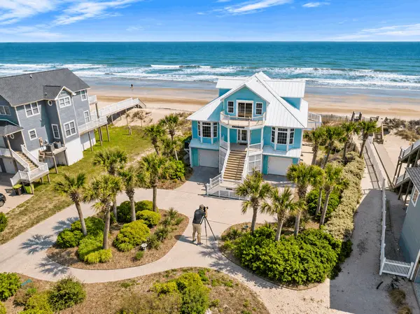
For oceanfront homes on Topsail Island, drone photography can help show the relationship between the home, the beach, and the surrounding coastline.
An aerial perspective may communicate:
-
The home's position in relation to the ocean.
-
Beachfront setting and surrounding shoreline.
-
Decks, outdoor living spaces, and pools.
-
The property's relationship to neighboring homes.
-
The overall coastal setting.
For a prospective buyer considering an oceanfront property in Surf City, Topsail Beach, or North Topsail Beach, these views can help communicate aspects of the property that interior photographs cannot.
2. Waterfront Homes With Docks, Boat Lifts, or Water Access
Waterfront properties often have features that deserve more attention than a traditional exterior photograph can provide.
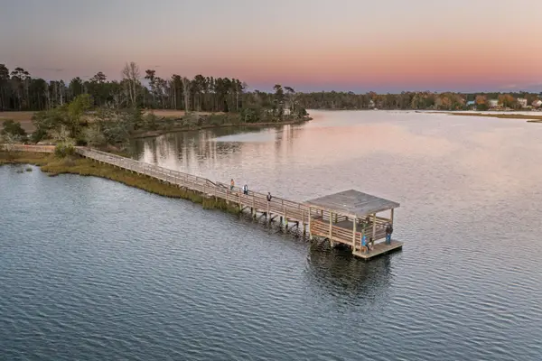
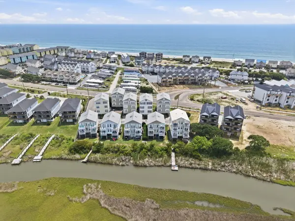
For homes along the Intracoastal Waterway, New River, and surrounding waterways, drone photography can help show:
-
Private docks and boat lifts.
-
Bulkheads and waterfront improvements.
-
Water frontage and surrounding shoreline.
-
Outdoor entertaining areas.
-
The home's position along the water.
For waterfront Sellers in Sneads Ferry, Holly Ridge, and North Topsail Beach, aerial photography may help buyers better visualize how the property relates to the water.
It is important to remember that aerial photographs do not establish legal waterfront boundaries, riparian rights, navigability, or dock permits. Those details should be verified through the appropriate records and qualified professionals.
3. Large Lots and Properties With Unique Land Features
When a home sits on a larger lot, traditional photography may not adequately communicate the property's overall layout.
Drone images can help illustrate:
-
The approximate layout of the homesite.
-
Outdoor improvements.
-
Detached garages or additional structures.
-
Cleared and wooded areas.
-
Driveways and access areas.
-
The property's relationship to surrounding land.
This can be particularly useful for properties in Holly Ridge, Sneads Ferry, and portions of Pender and Onslow Counties where lot size, privacy, and usable outdoor space may be important considerations.
Aerial images should not be presented as surveys or definitive property boundary measurements.
4. Homes With Pools and Outdoor Living Spaces
Some properties offer outdoor features that are difficult to appreciate from a single ground-level photograph.
Drone photography may provide a better view of:
-
Private swimming pools.
-
Large decks and patios.
-
Outdoor kitchens and entertaining areas.
-
Landscaping and yard layout.
-
Multiple outdoor living areas.
-
The relationship between the home and its recreational features.
For coastal homes marketed as vacation properties or second homes, these features may be an important part of the property's overall presentation.
5. Properties Where Location Is a Major Selling Feature
Sometimes the most important selling feature is not inside the house. It is where the house is located.
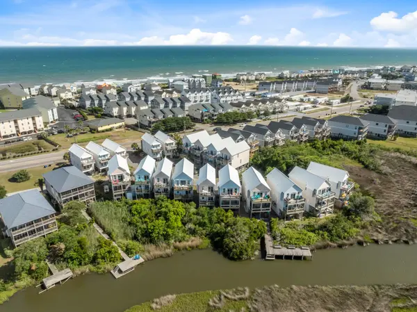
Aerial photography may help illustrate a property's surrounding environment, including its proximity to:
-
Beach access.
-
Waterways.
-
Community amenities.
-
Marinas and boat access.
-
Parks and recreational areas.
-
Surrounding neighborhood features.
For Coastal North Carolina properties, location can be an important part of the buying decision.
However, marketing images should accurately represent distances and access. An aerial image should never imply private beach access, deeded access, or a particular property feature that has not been verified.
Does Every Home Need Drone Photography?
No. Drone photography should be selected based on the property rather than treated as a mandatory part of every listing.
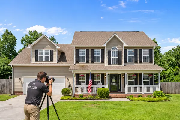
For example, a home in an established Wilmington neighborhood may benefit more from professional interior photography, detailed room images, and a well-presented floor plan.
A waterfront home in Sneads Ferry, on the other hand, may benefit considerably from aerial images showing its dock, water frontage, and surrounding setting.
The important question is:
Will aerial photography show prospective buyers something meaningful that traditional photography cannot?
If the answer is yes, drone photography may be a worthwhile addition to the marketing plan.
If the aerial images do not communicate additional information or highlight a relevant property feature, the investment may be better directed toward other marketing elements.
Drone Photography vs. Traditional Real Estate Photography
Drone photography and traditional real estate photography serve different purposes. They work best when used together rather than as replacements for one another.
|
Traditional Photography |
Drone Photography |
|---|---|
|
Shows interior rooms and finishes |
Shows the property from above |
|
Highlights kitchens and bathrooms |
Highlights lot layout and surrounding setting |
|
Captures details and craftsmanship |
Shows waterfront and outdoor features |
|
Communicates interior space |
Communicates location and property surroundings |
|
Helps buyers visualize the home |
Helps buyers understand the property's broader setting |
A strong listing presentation considers which types of photography will best communicate the property's features.
For many Coastal North Carolina homes, combining professional interior and exterior photography with selected aerial images creates a more complete visual presentation.
Should Drone Video Be Included in a Real Estate Listing?
Drone video can be particularly useful when the property benefits from showing movement and perspective.
Rather than relying entirely on still images, aerial video can help demonstrate how a home sits within its surroundings.
Depending on the property, drone video may show:
-
The approach toward an oceanfront home.
-
The surrounding waterfront.
-
A dock and boat lift.
-
Outdoor entertaining areas.
-
The relationship between the home and nearby beach access.
-
A broader view of the neighborhood.
Drone video may also be incorporated into a larger property marketing video that combines aerial footage, professional interior photography, and exterior video.
Not every listing requires a dedicated video production. The format should support the property's marketing objectives.
What Should Sellers Ask Their Listing Agent About Drone Photography?
Before hiring a listing agent, homeowners should understand how photography and visual marketing will be handled.
Consider asking:
-
Will drone photography be used if my property would benefit from aerial images?
-
Who will be responsible for coordinating the photography?
-
Does the marketing plan include aerial photographs, video, or both?
-
How will the aerial images be incorporated into the online listing?
-
Are there any restrictions that could prevent drone photography at my property?
-
What other photography and marketing services are included in the listing plan?
These questions help Sellers understand whether the proposed marketing strategy is designed around their property's actual features.
A listing agent should be able to explain why particular marketing elements are being recommended rather than simply offering the same package for every property.
Are There Restrictions on Drone Photography in North Carolina?
Yes. Drone photography for a real estate listing involves more than simply operating a drone over a property.
Because the photography is being used to advertise real estate, it is considered commercial drone activity. The North Carolina Department of Transportation explains that commercial drone operations can be conducted under the FAA's Part 107 requirements. Commercial operators must hold the appropriate FAA Remote Pilot Certificate or operate under the direct supervision of a certificated remote pilot.
There are also airspace considerations. Some locations require FAA authorization before a drone can operate, particularly in controlled airspace near airports.
North Carolina law also addresses privacy and the use of drones to conduct surveillance of private property or photograph individuals without consent in certain circumstances.
This is particularly relevant when marketing homes in coastal communities where properties may be close together or near airports and other restricted areas.
Sellers should work with a qualified drone operator who understands applicable FAA requirements, North Carolina restrictions, property permissions, and location-specific flight considerations.
How Does Streamline Realty Team Use Drone Photography in Its Listing Marketing?
Streamline Realty Team recognizes that different properties require different marketing approaches.
For some listings, professional interior and exterior photography may provide the strongest presentation. For others, aerial photography and drone video can help communicate property features that would otherwise be difficult to show.
Streamline's listing marketing services may include professional real estate photography, drone/aerial photography, floor plans, video, online listing exposure, and digital marketing, depending on the property and its marketing strategy.
This can be especially relevant for Coastal North Carolina properties where the surrounding setting is an important part of the property's appeal.
For example, an oceanfront home on Topsail Island may benefit from aerial images showing its relationship to the shoreline, while a waterfront property in Sneads Ferry may benefit from images highlighting its dock, boat lift, and water access.
The objective is to select marketing tools that help prospective buyers understand the property and its most relevant features.
Does Drone Photography Help Sell a Home?
Drone photography can improve the visual presentation of a property and provide prospective buyers with additional information about its location and setting.
However, aerial photography alone does not guarantee more showings, a faster sale, or a higher selling price.
Its value depends on how relevant the images are to the property, how professionally they are produced, and how they fit into the overall marketing strategy.
Pricing, property condition, market competition, presentation, exposure, and buyer demand all remain important considerations when selling a home.
For Sellers, the goal should be to develop a marketing plan that accurately and effectively communicates what makes their property worth considering.
Thinking About Selling Your Coastal North Carolina Home?
Not every property needs the same marketing strategy. The best approach begins with understanding what makes your home different and determining how those features should be presented to prospective buyers.
Whether you own an oceanfront home in Surf City, a waterfront property in Sneads Ferry, a vacation rental on Topsail Island, or a primary residence in Wilmington or Jacksonville, Streamline Realty Team can help you evaluate the marketing opportunities for your property.
Before listing, let's discuss how your home should be positioned and marketed.
Contact Streamline Realty Team to schedule a Seller consultation and review a property-specific marketing plan, including whether professional drone photography, aerial video, and other enhanced marketing options make sense for your home.
Streamline Realty Team | Powered by Real Broker, LLC
Categories
Recent Posts

GET MORE INFORMATION